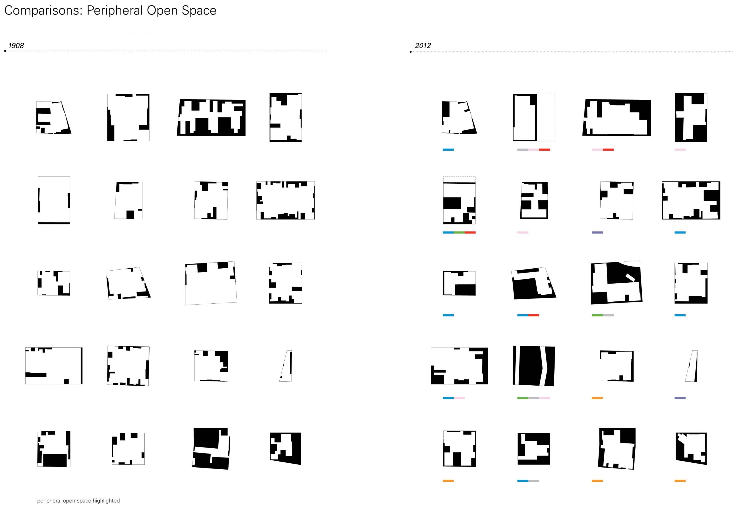
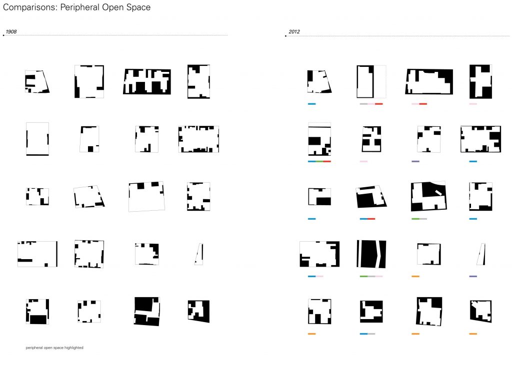
Popular contentions about the shrinking city often involve what to do with a preponderance of vacancy. The process of urban decay, so it’s told, involves the slow decline, depopulation then abandonment of city — mostly residential — districts in concert with the perpetuating — mostly economic — cause. In its wake we’re left with fewer people, weakened vitality and neglected property or outright openness. New Orleans offers an interesting counter to this narrative. Be that as it may there are occasions where the desire to develop exists in even its most depressed sections — infill mostly, defying a tendency to expand given New Orleans geographic particulars — all while the governing realities remain: the city is smaller and cannot support a housing unit or commercial density equivalent to its peak. The purpose of this research document is to catalog a representative section of the City — Central City, the largest neighborhood district — as a vehicle to enliven this discussion and reintroduce the role of physical space. While not meant to offer a clear conclusion or answer, this series of visual and graphic inquires illustrate a pattern of historic development at the turn of the last century in comparison to its current form, moving beyond statistics to express the actual visual density. This juxtaposition allows us to observe the given fabric relevant to its beginnings, exposing changes and consistencies that provide a foundation for establishing intellectually challenging designed interventions and provocations.
VISUAL DENSITY
-
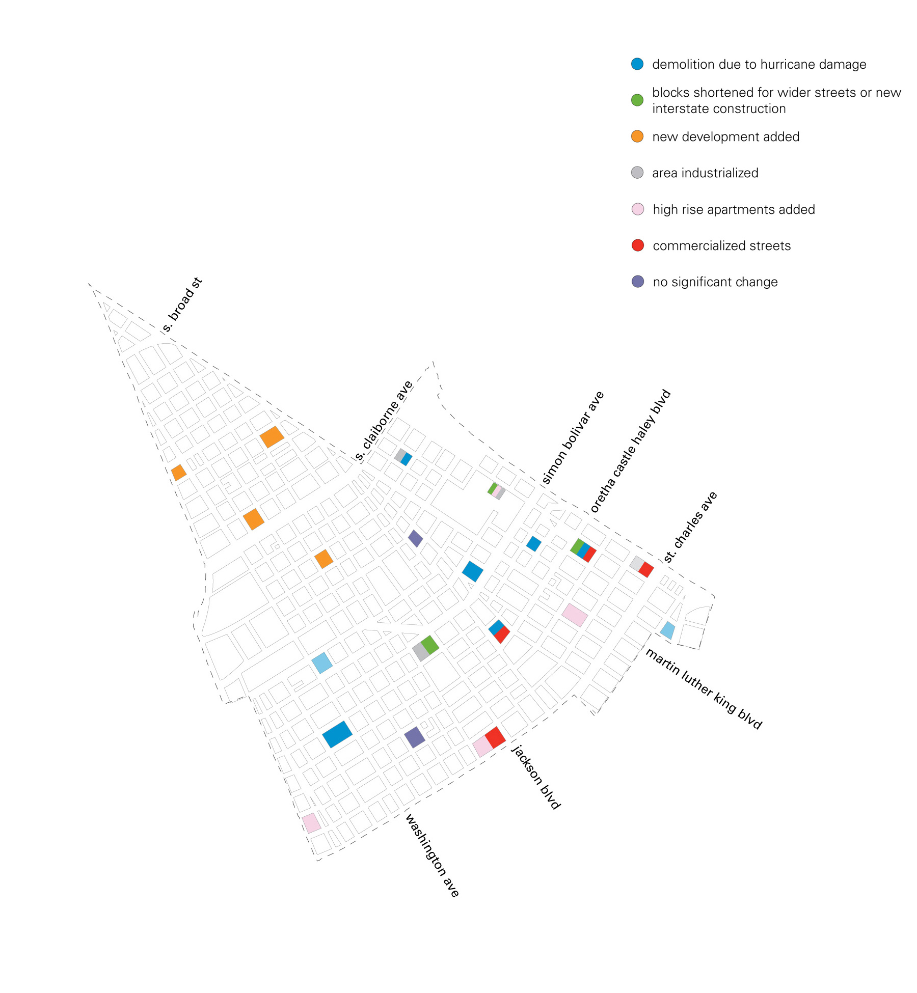
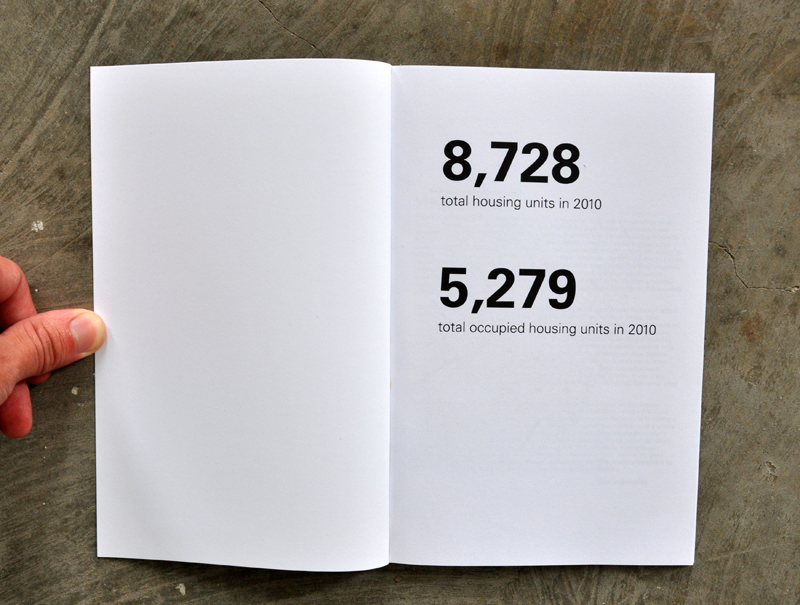 Issues of historic density, occupancy, and disinvestment transform a Central City neighborhood over time
-
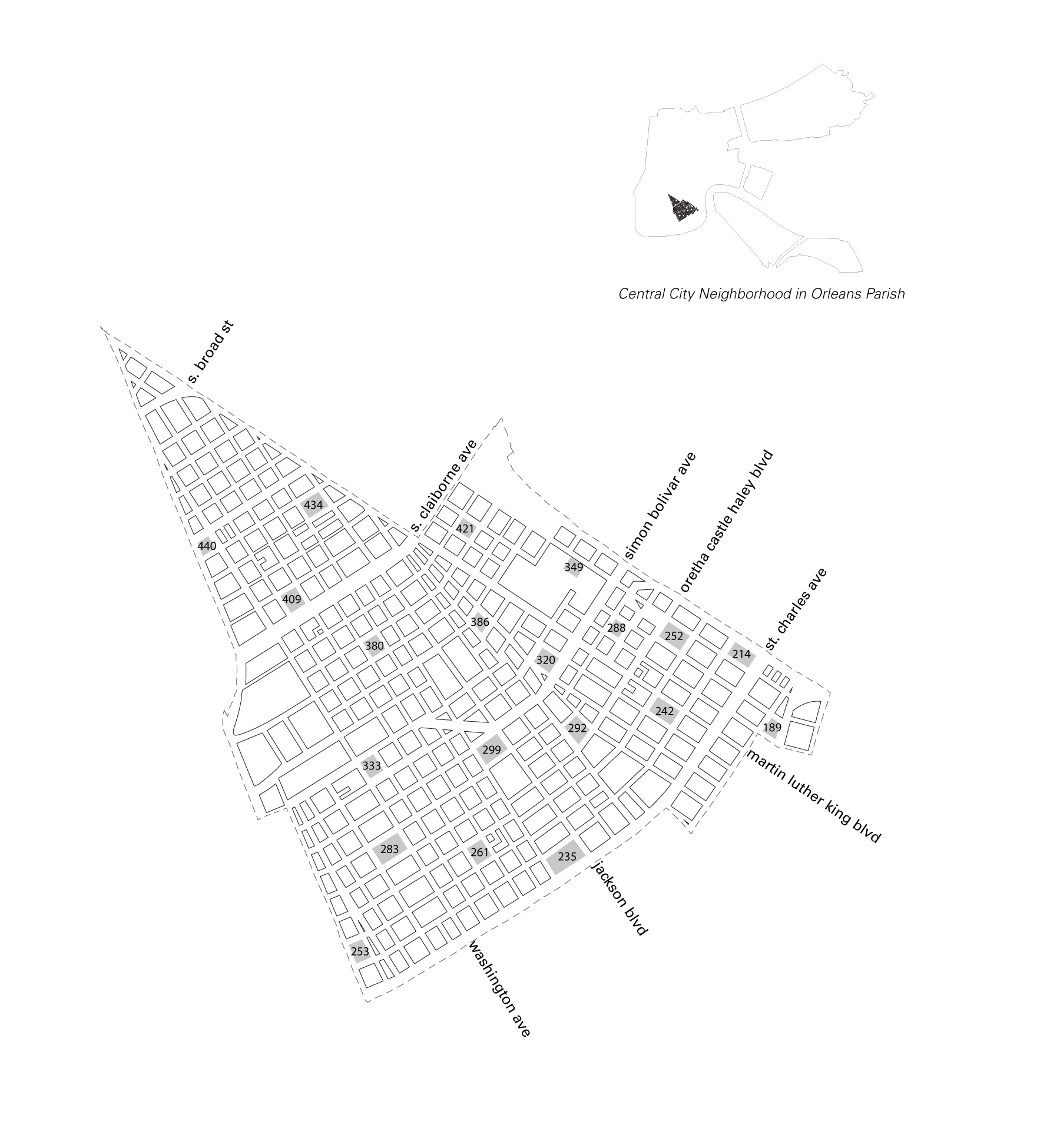
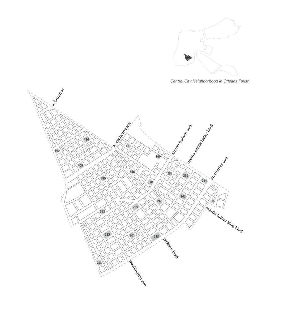 Selected sites in Central City for analysis
-
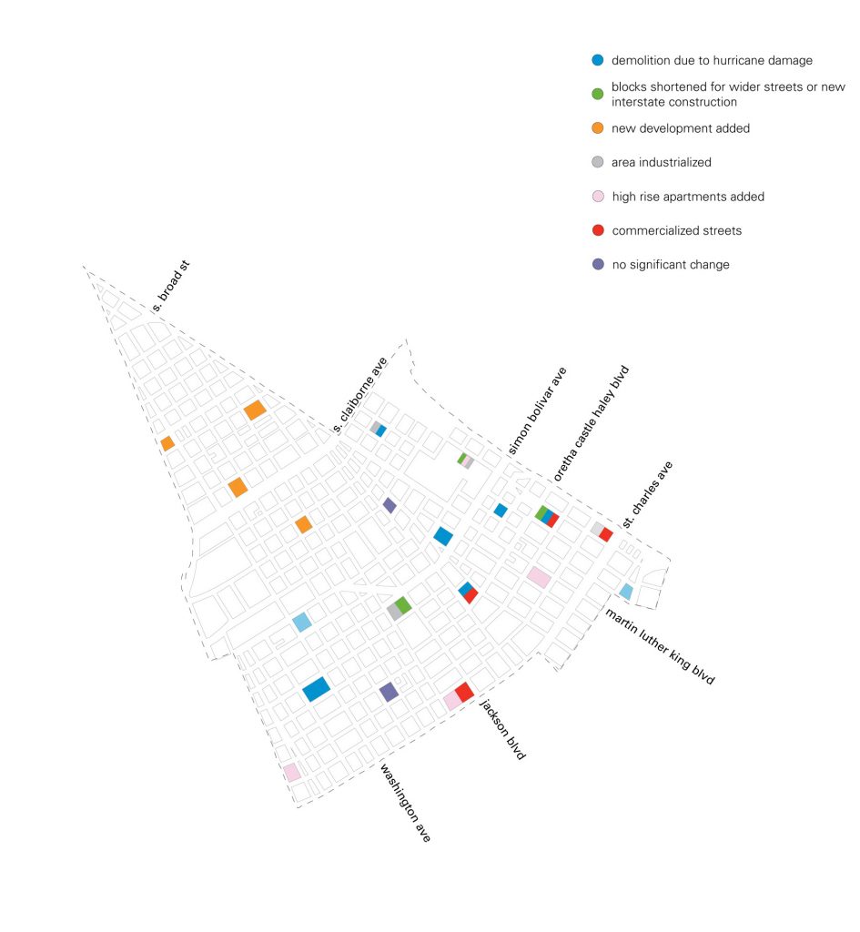 Catalogue of conditions affecting individual sites
-
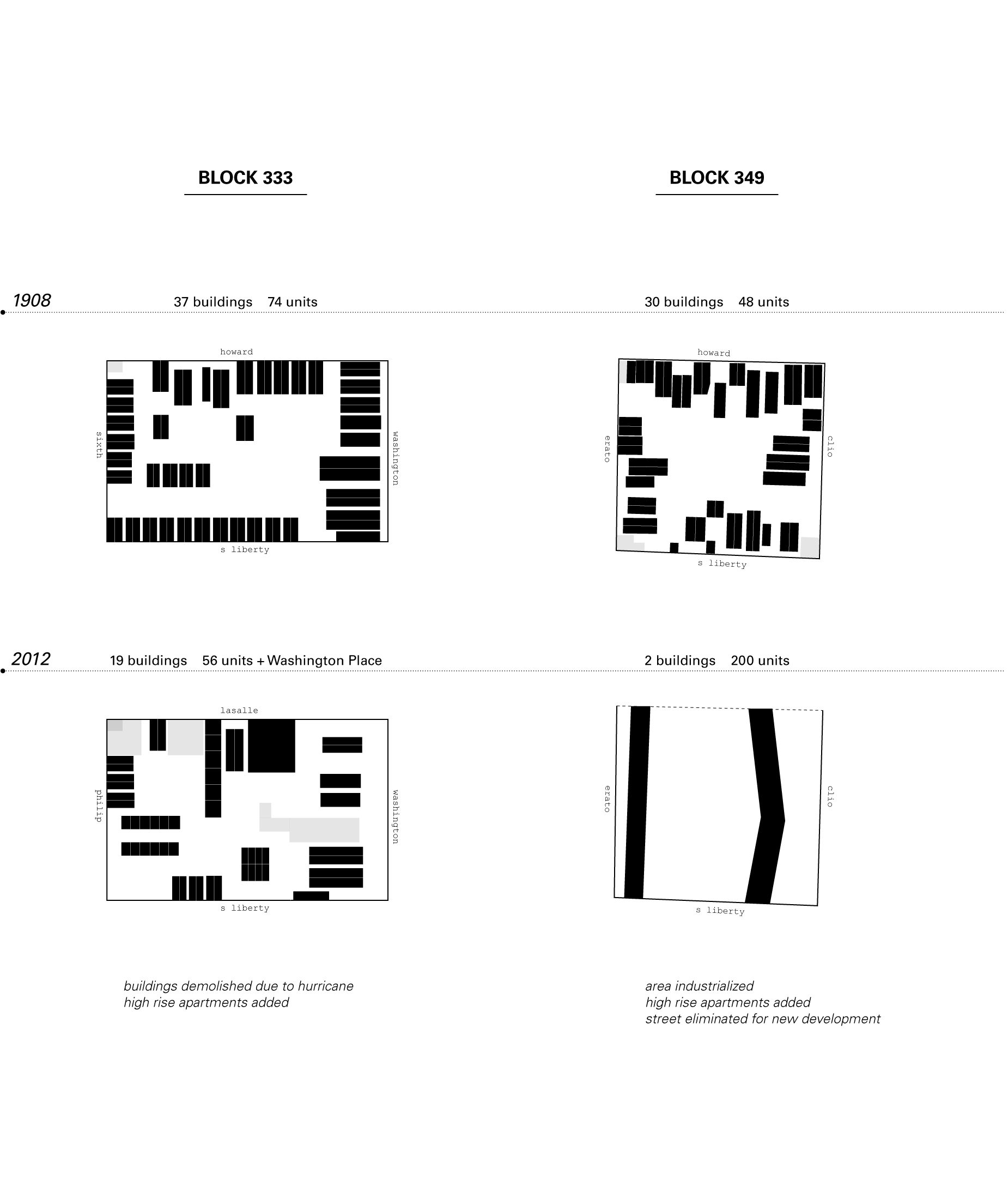
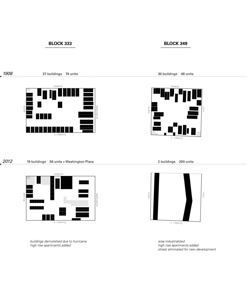 Sample from individual block analysis
-
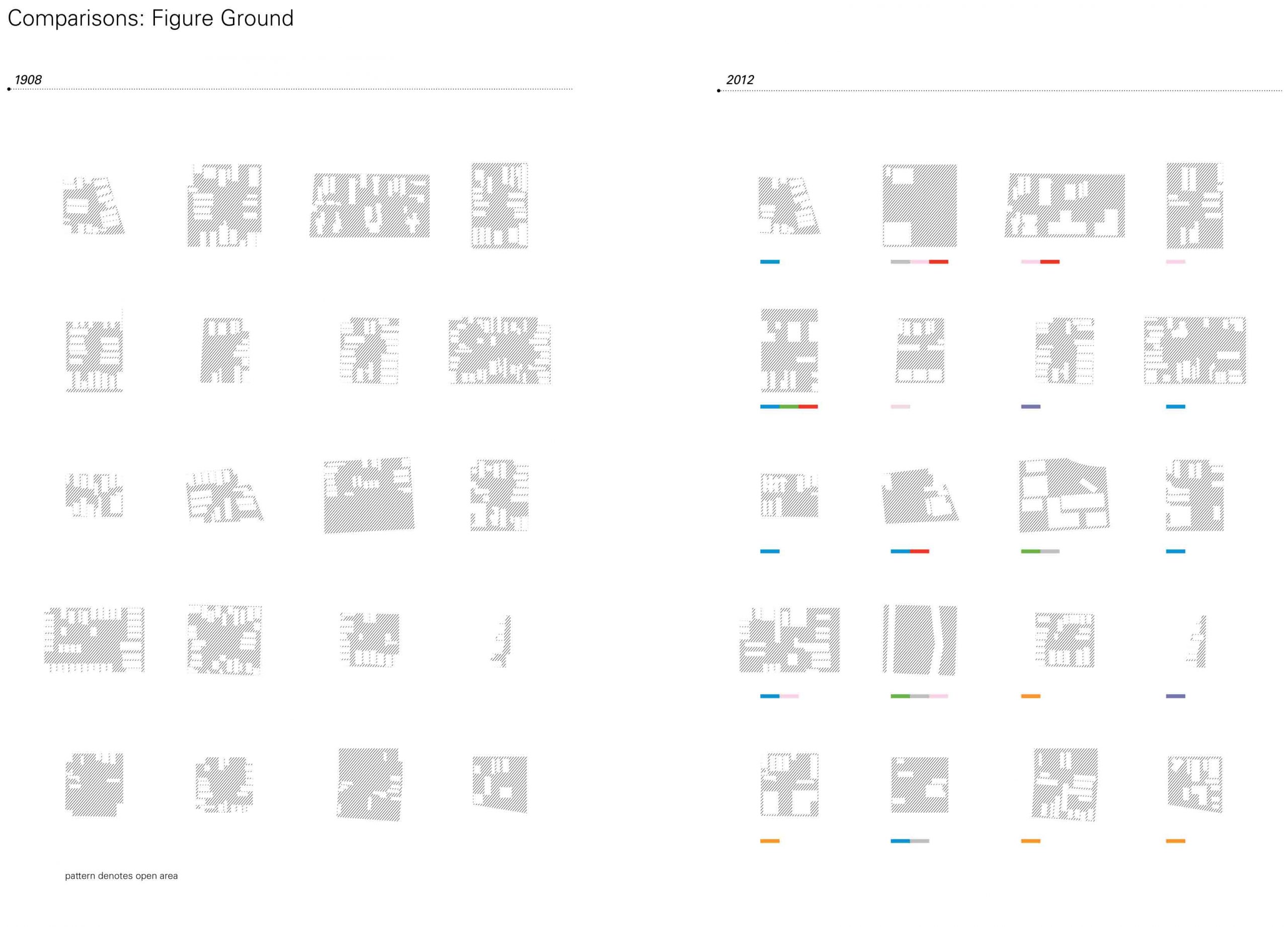
 Comparisons of blocks as a group with figure grounds
-
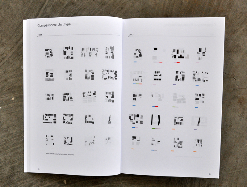 Comparisons of traditional housing unit types
-
 Comparisons of blocks as a group by unit type
-
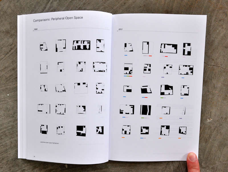 Comparisons of blocks as a group with peripheral open space
-
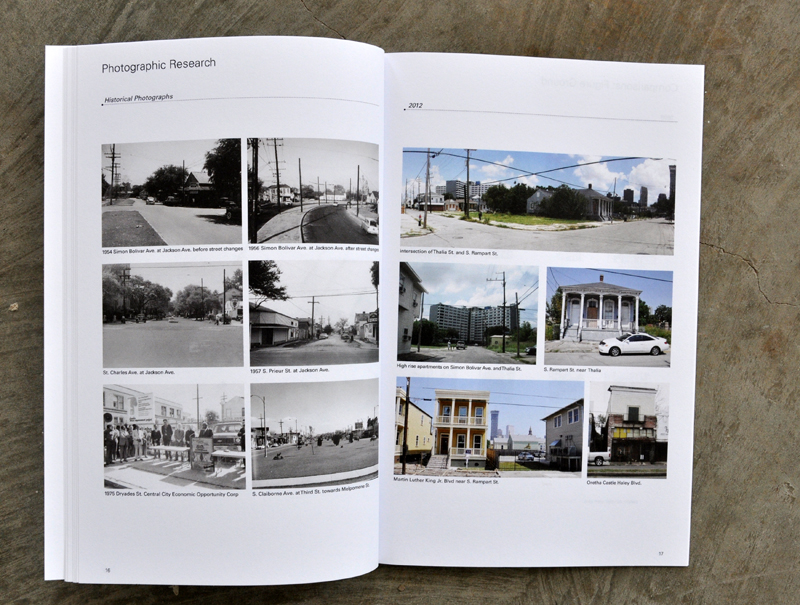 Comparative photographic research in the architectural landscape
-
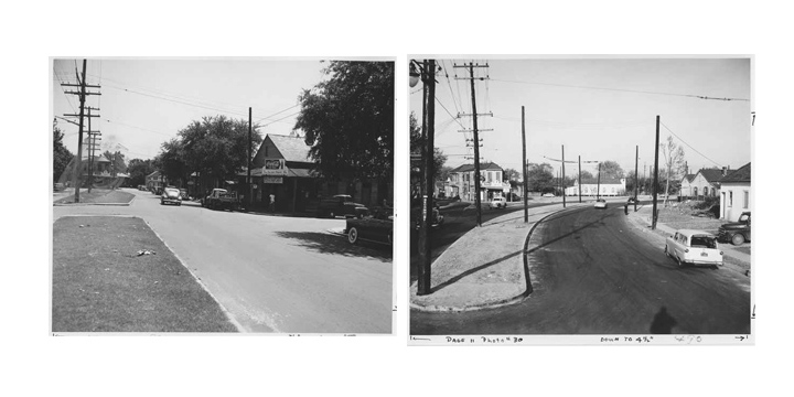 Historical photographs of Simon Bolivar before and after changes
-
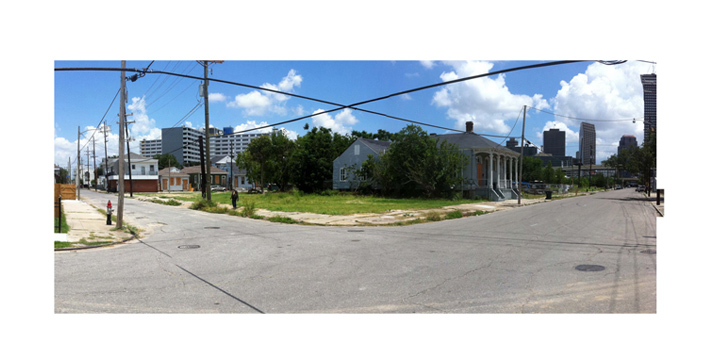 Site today at Rampart Street and Thalia Street
