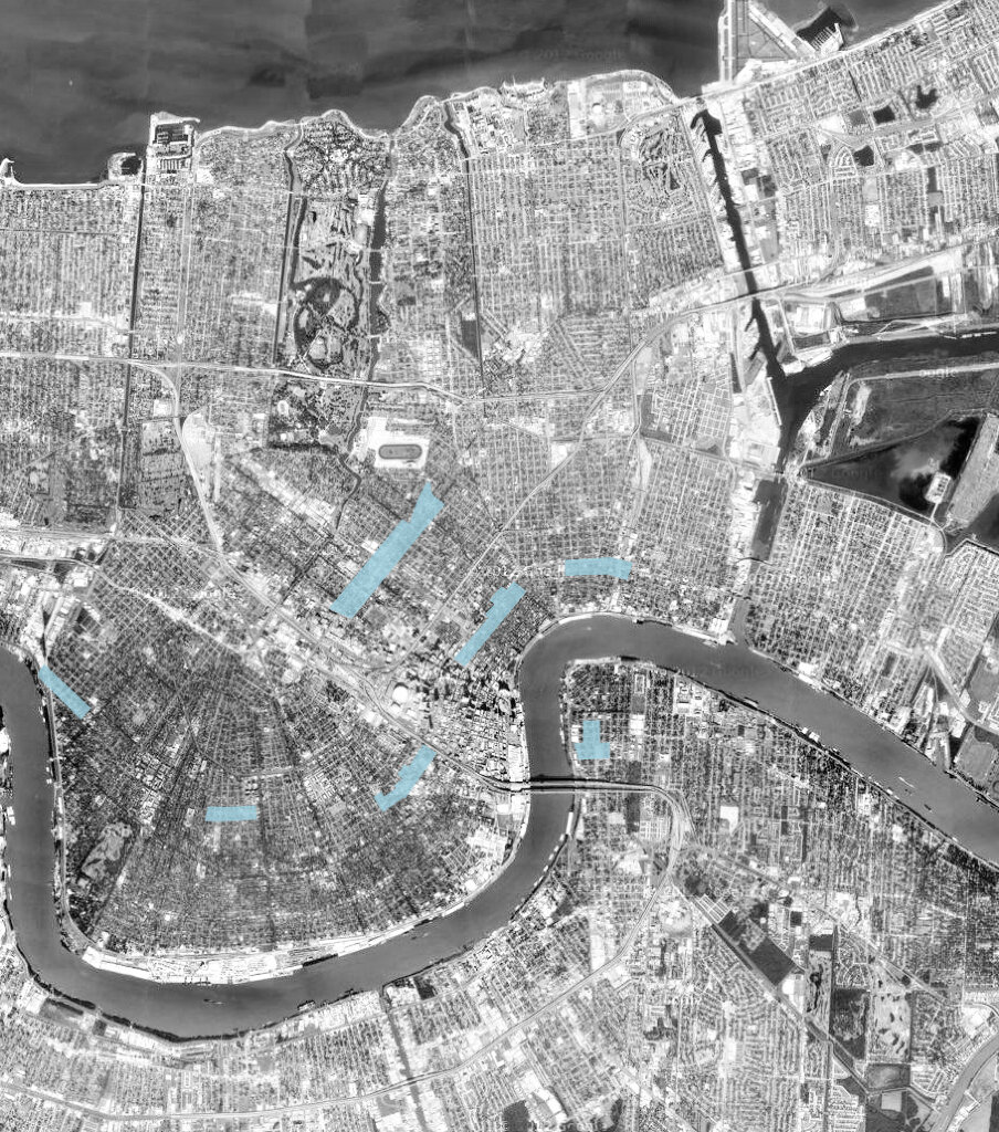
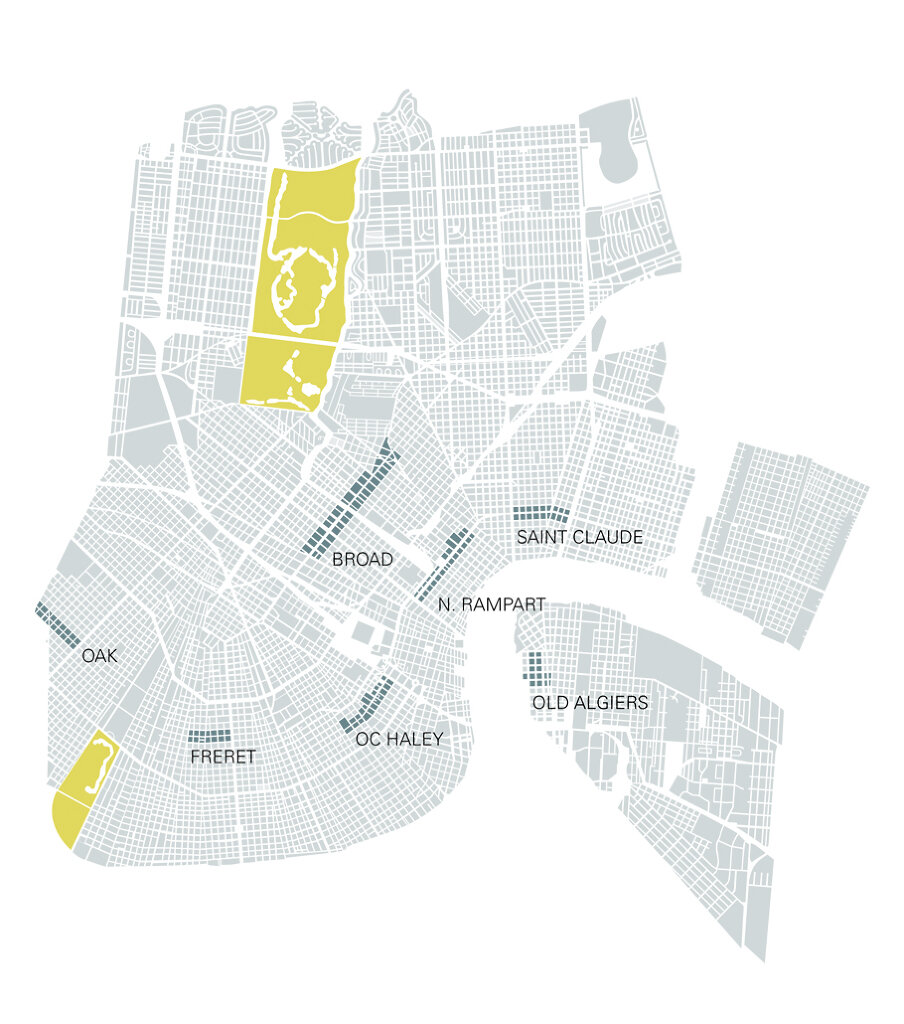
In the flux of urban development, commercial districts come to life, decline, then resurrect themselves in different ways. The trend can be tracked in New Orleans both in the specific historic progression of its footprint but also in response to phenomena present in many US cities (suburbanization, economic decline, etc.). The physical form itself of the city’s neighborhood fabric is, however, quite distinct, following a linear pattern prefaced on lengthy, street-centric, non-nodal developments. Capturing the presence of this condition most recently is a preponderance of Main Streets Programs (NPS) within New Orleans. Allowing a foothold into historic tax credits, these zones possessing the building fabric necessary to support their development have begun to reposition themselves as attractors of investment.
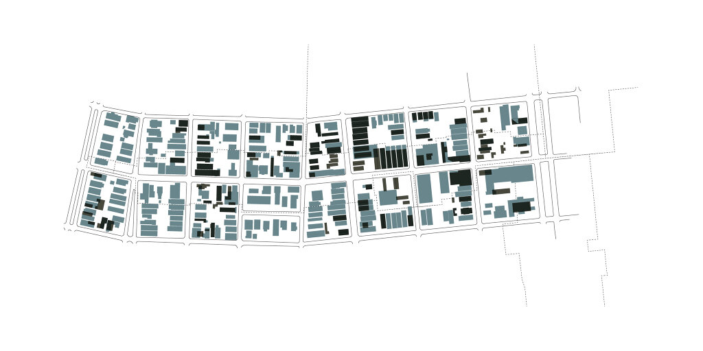
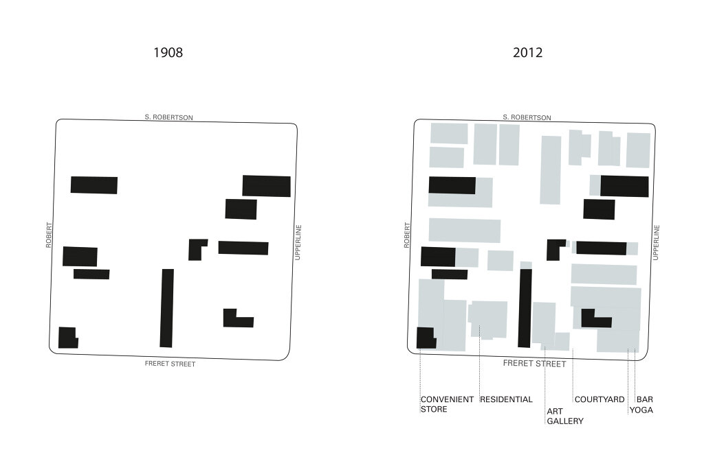
The purpose of this investigation is to track these developmental shifts over time in the main street districts, cataloging the specific changes in the physical fabric in response to development pressures. Aside from mining historic maps of the city, economic data — a requirement of the Main Streets Program — is being used to track actual investment. The proposed result is a document that graphically represents the ephemeral process involved in reshaping our historic commercial cores.